History |
Langton Helps Save the Nation
We are grateful to Dr Phil Judkins for contributing this article about the importance of Langton Matravers and Worth Matravers to the development of radar in the Second World War. Dr Judkins, who lives in Yorkshire, is an eminent radar historian who has given many talks throughout the country. He is Chairman of The Purbeck Radar Museum Trust, details of which can be gained through http://www.purbeckradar.org.uk/.
Today, Langton is a quiet Dorset village, but for a time, during the Second World War, this was part of Britain’s Silicon Valley!
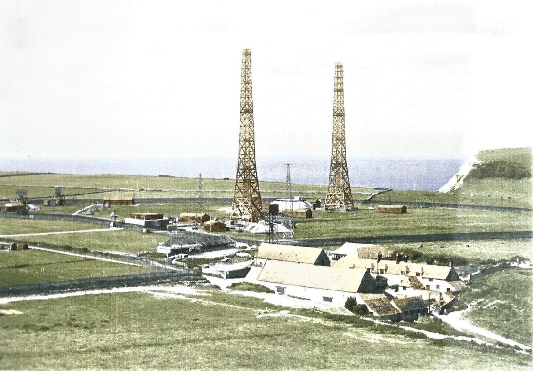
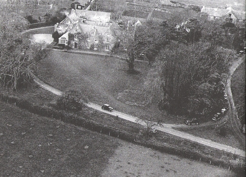
In May 1940, 200 of Britain’s top scientists moved to Purbeck, to Langton and Worth Matravers to concentrate on the highly secret development of radar – so important that within only two years their numbers had risen tenfold, to 2,000. This was where the “best of our best” at Langton and at Worth produced the radars we today take for granted in our aircraft and our boats. Our scientists originally did their researches at Orfordness, next at Bawdsey (both in Suffolk), then on the outbreak of war in 1939 evacuated to Dundee. But the need was for a much bigger research site than Dundee could provide. France was not thought likely to surrender, and Purbeck then was beyond the reach of bombers operating from Germany. So a new site near Renscombe Farm at Worth was chosen, and called TRE, the Telecommunications Research Establishment. Its scale was vast – over 2,000 scientists, engineers, technicians and support staff worked here, and were billeted over all the surrounding villages and in Swanage. This is what you would have seen from the air at Worth in 1940-2. Crown Copyright, coloration J. Penley for Purbeck Radar Museum Trust, by permission
Within days of the scientists arriving here in 1940, the Germans invaded France, which fell within weeks. From being a location safe from air attacks from Germany, Purbeck was in the front line of attacks from France.
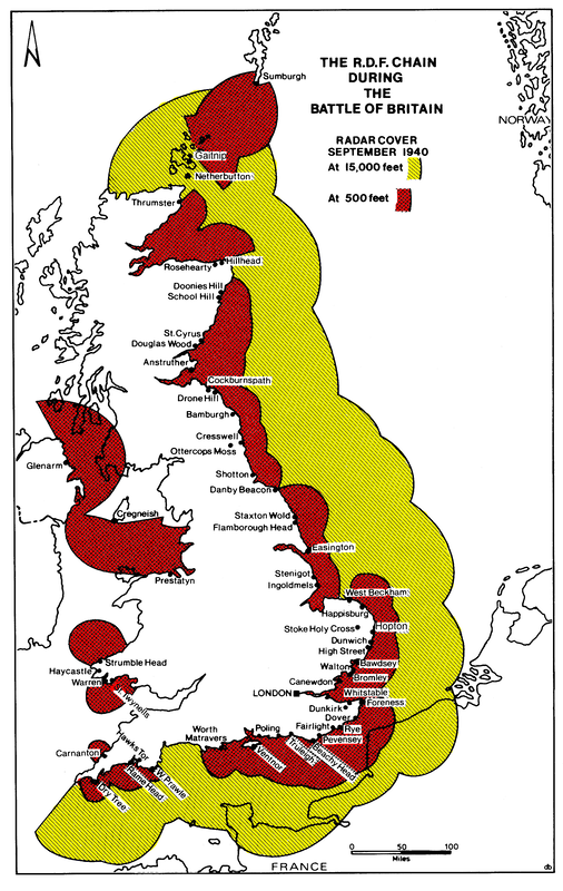
The scientists had, of course, been building our radar early warning system since 1936, and by the time of the Battle of Britain that early warning system, radars called “Chain Home” extended all round our East and South Coasts. Crown Copyright, coloration S/Ldr M.S. Dean MBE, by permission
Able to see over 100 miles, our radar operators, many of them women, could spot German formations building up over France, and provide the warnings to our Hurricanes and Spitfires to get into the best positions to intercept them. Chain Home was far from perfect – it was tricky to operate and was often inaccurate, but the female operators of the WAAF were usually able to provide a good warning in plenty of time.
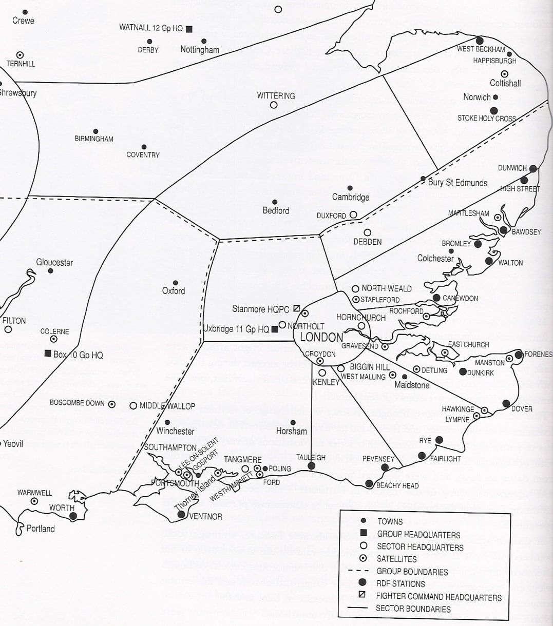
The farmer at Renscombe, Mr James, stuck to his farm throughout, though he had only land left for pigs and poultry; however, he made a few pence by selling tea and buns to the scientists on the site! The importance of Worth is obvious if you look at the map of the area over which the Battle of Britain was fought. Roy Conyers Nesbit, The Battle of Britain, Stroud: Sutton, 2000
Worth – though only intended for research use, and hastily pressed into operational service - became the southern anchor of the early warning chain – the more important since Ventnor radar, on the Isle of Wight, had a lot of difficulty estimating the height of attackers, and was in any event out of action for some time after a bombing attack.
Worth covered the approach tracks from France to Portland, a major naval base, and to Bristol – it was in a key position, and it discharged its duty well. You can see here the result of just 15 minutes fighting over the local area on the 27 September 1940, when 6 Messerschmitt 110s were shot down, and a further one exploded in the air after being rammed head-on by the Spitfire of P/O Miller, an Australian pilot of 609 Squadron from Warmwell. 609 and 152 Squadron’s Spitfires claimed 12 kills and 4 damaged on that day, one of the hottest in the Battle. Crown Copyright
The Germans also tried to fly in “under the radar” – quite literally, the first time anyone tried this!
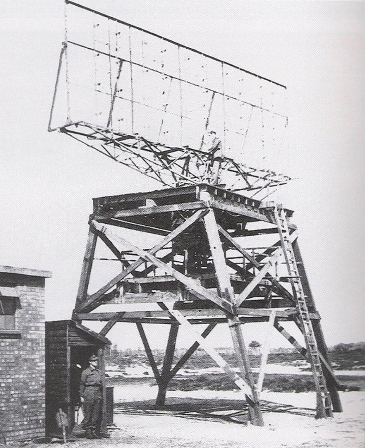
Here again TRE was ready for them, with a radar in the quarry under St Aldhelm’s Head whose foundations you can still see today, but the radar was so crude we today can’t believe it! Our low-level early warning radar was called Chain Home Low, and instead of tall towers, it had the sort of aerial you might see going round and round on an airfield today. Crown Copyright
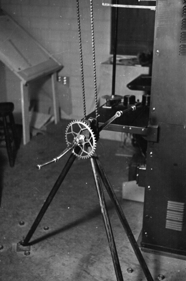
In 1940, the aerial just swung back and forth, because we couldn’t do rotating in a circle yet; the operators watched and could read off the range of the target, but not yet its height. They knew its bearing from the bearing of the aerial when the target was in view – but how was the aerial being turned?
The scientists just modified a pushbike frame for hand operation, with the bike chain turning the aerial and an airman turning the pedal cranks by hand. Crown Copyright
The aerial turning task was not much in demand! – the airmen doing it were called “binders”, hence a later radio popular show of RAF life called “Much Binding in the Marsh”. In a true spirit of equality, on at least one site, Wherwell, the task was carried out by the women of the WAAF who also operated the radar. The key point was, it worked! Here is one shot-down Heinkel in the sea just offshore.
Crown Copyright
But TRE never lost its sense that the important mission was to attack rather than simply defend, and here’s where Langton comes in.
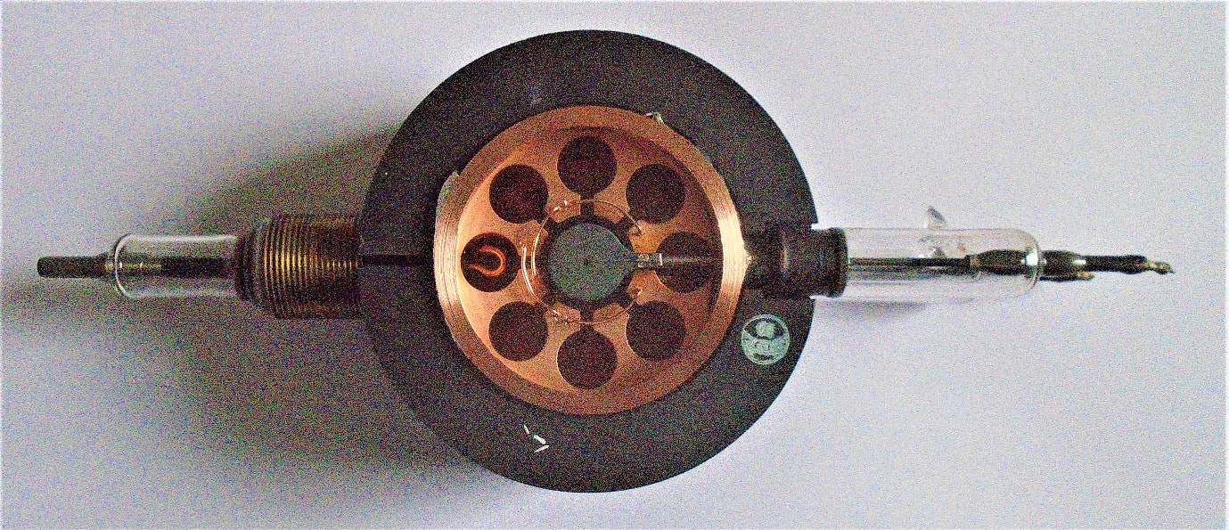
This unimpressive piece of ironmongery was the key as well as powering the microwave oven in your kitchens at home today. Dr P Judkins, by permission
In February 1940, two researchers at Birmingham, Randall and Boot, were experimenting with trying to generate high powers at microwave frequencies. To their surprise, they succeeded with a device called the magnetron, which works rather like a series of whistles connected together and surrounded by a powerful magnet. Other researchers contributed ideas to make it even better, and then the GEC company worked out a way of being able to mass produce it.
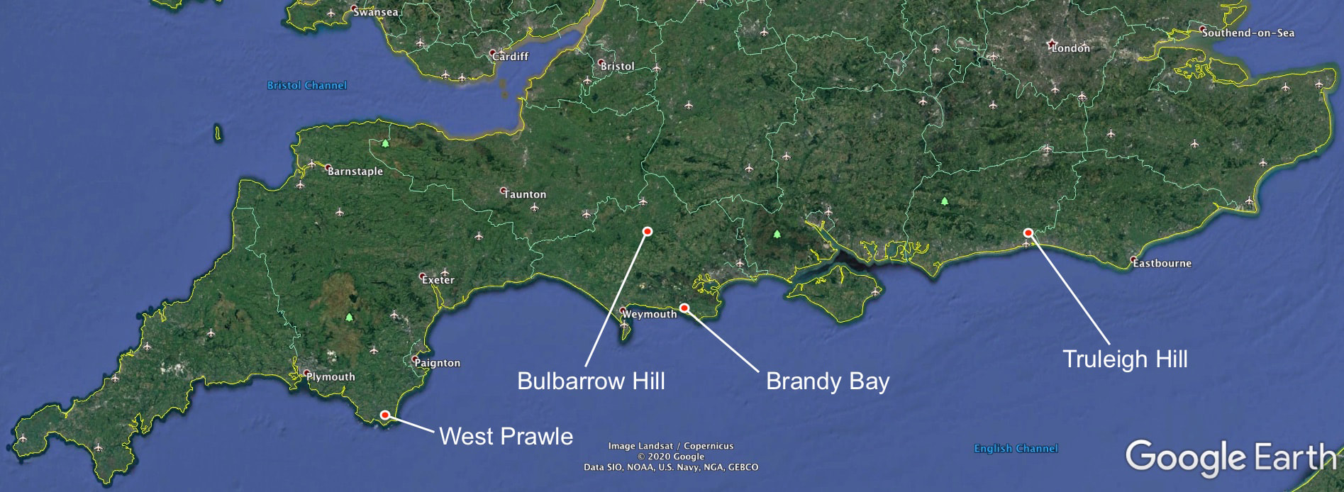
Its importance was that it was powerful, it was small, it was robust, and the size of radar aerials is a result of the frequency you generate your power at – if you generate it simply at high frequencies, you have a huge aerial like Chain Home; if you generate it at very high frequencies, you have an aerial like Chain Home Low, or like an old telly aerial; but if you generate it at microwaves, you have a small dish, like a Sky TV dish. No prize for guessing which the Air Marshals and Admirals wanted! This was the core of a lot of the work at Langton, in Leeson House – and of your microwave oven at home. But we had another secret weapon – the long-departed Grosvenor Hotel, Swanage. It was a place where everybody came together to solve problems - simple, but most organisations never do it. The head of TRE, “Jimmy” Rowe, held what he called “Sunday Soviets” to crack the technical problems of the war, and to the Grosvenor came Government Ministers, Air Marshals, Admirals and their staffs, operational airmen, sailors and the TRE scientists, to discuss problems, with the only rule being that anyone could say anything just as long as it was relevant. As Prime Minister Churchill said, “In war, you don’t have to be polite, you just have to be right”. There was nothing remotely like this in Germany or Japan – not much like it in the USA, either – but it solved many of our wartime problems. And the first of those problems was helping our bombers find their way at night. It had been assumed the bombers were navigating well with sextants and radios, but in 1941 a report showed that most of our bombers were not bombing within 75 square miles of the target. This is not very surprising if you think of taking a star shot with a sextant on a aircraft bouncing around the sky on a cloudy or stormy night while you were being shot at. Here’s where Langton comes in! An idea called GEE, which Bob Dippy, a scientist now at Langton’s Durnford House, had thought of before the war, was resurrected from its file, and was now put on the URGENT list. The idea for GEE was pretty simple, and we can describe it by looking at the 4 stations of what was called the Southern GEE chain – Bulbarrow Hill, West Prawle, Truleigh, and Brandy Bay. Bulbarrow Hill would transmit a pulse of radio energy; when it received it, Truleigh Hill would transmit one too; after a fraction of a second’s delay, Bulbarrow Hill would transmit another pulse, and when West Prawle received it, it would transmit another. Then the whole cycle would start again.
A ship, or an aircraft, out in the Channel, would receive the two sets of pulses, and by looking at them as two lines on a display screen and putting some calibration “pips” in place, could obtain two sets of co-ordinates which it could relate to a special map, and find its position where the lines representing the two co-ordinates crossed. A lot simpler, and more accurate, than a star shot, especially if it was stormy or you were being shot at, and the big advantage of GEE was that you didn’t need to transmit to find your position – because in war, transmitting gives your position away to the enemy! Pitstone Green Museum of Rural Life http://www.pitstonemuseum.co.uk/
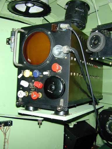
This is all the kit you needed in your aircraft or your ship –an indicator unit to show the two lines with two sets of pulses, and a receiver.
Waddington Heritage Centre http://www.sbap.be/museum/waddington/waddington.htm
GEE was very extensively used by both RAF and Royal Navy after its first operational use in August 1941. The crews liked it because of its simplicity – sometimes it was called the “Goon Box” as any Goon could use it.
Back to another part of Langton - Leeson House. Crown Copyright
It was here that the scientists exploited much of the potential of the magnetron for making compact, accurate radars which could be fitted even in small ships and aircraft.
Jodrell Bank, University of Manchester
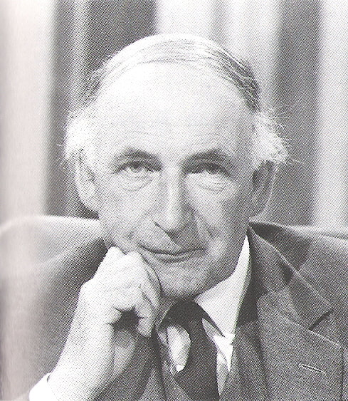
One of the key scientists making this possible was the late Professor Sir Bernard Lovell, later world-famous for radio-astronomy and the radio telescope at Jodrell Bank, but then a researcher in microwave radar and the application of the magnetron.
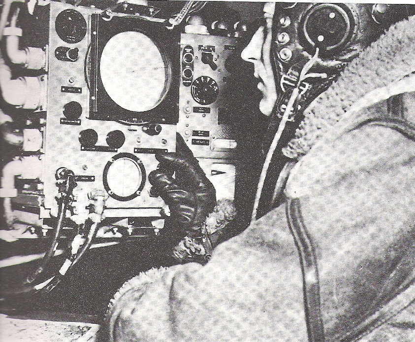
His first work was to use the magnetron to improve our night fighter radar, putting an aerial dish like a satellite dish in the nose of our fighters. Then in November 1941 it was identified that by tilting the dish aerial downwards, the radar set would trace out a shadowy map of the ground beneath. This was the origin of a blind bombing and navigational aid called H2S; here you see a Lancaster navigator and his display unit. Crown Copyright
What did the navigator see when he switched his H2S on?
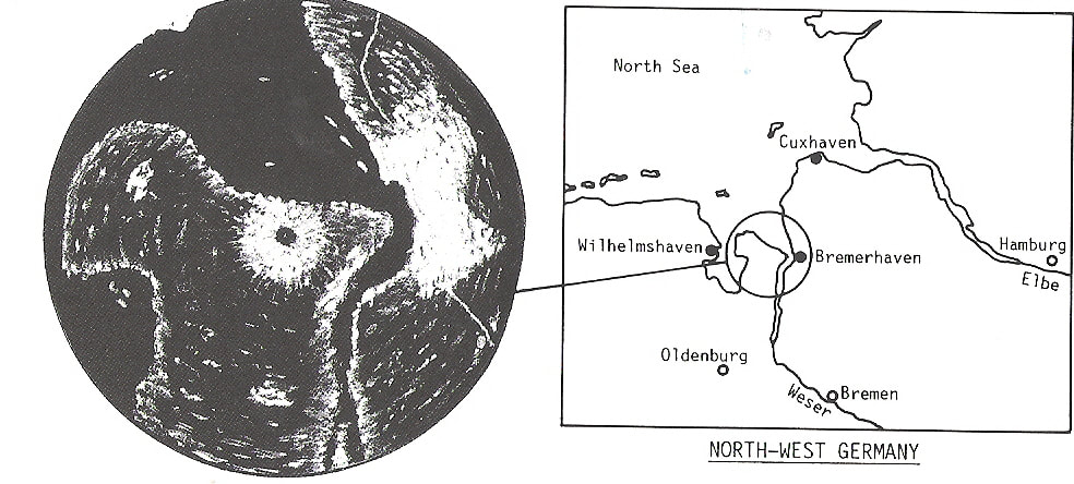
Well, if he was lucky and the set was working and conditions were good, he might see something like this on his H2S radar. Crown Copyright
This is the mouth of the Weser, and a picture of the H2S display of the same thing. You see that the coastline shows up sharply, and towns can be identified as smudges. This was a lot better than anyone expected – and indeed when Jimmy Rowe as head of TRE saw a photo similar to this from a research flight, he exclaimed “This is the turning point of the war!”.
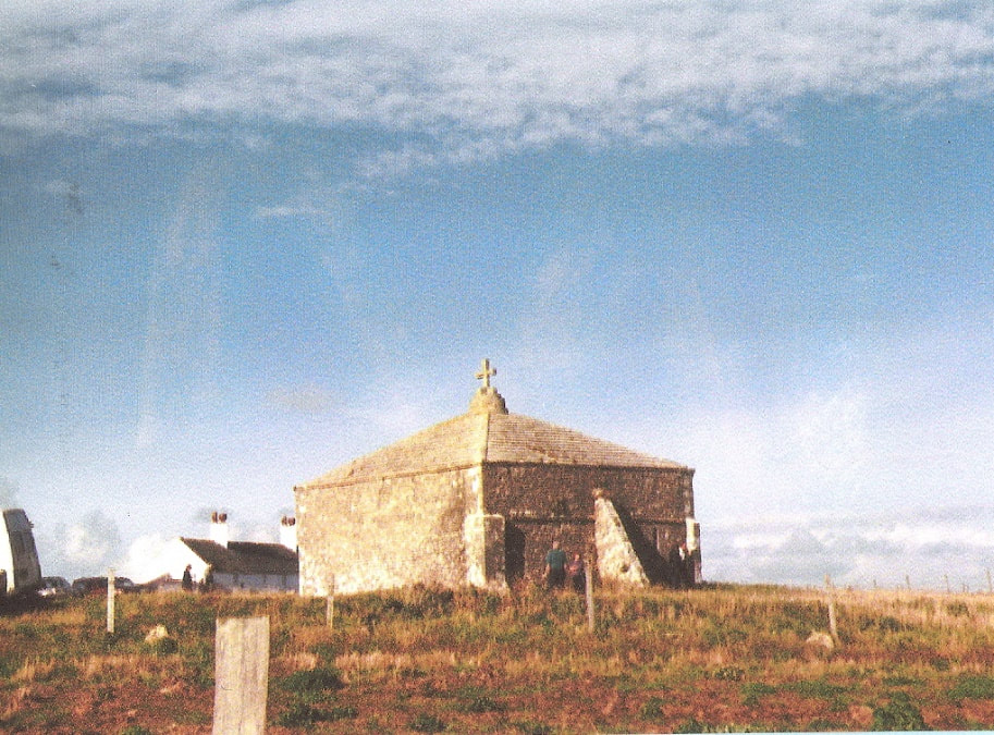
In practice, it took quite some time to bring into operational use – the first sets reached 35 Squadron in December 1942, and only 150 planes were equipped a year later. The results could be pretty variable, but it was light-years better than anything else and was intensively used in 1944-5. What, you might ask, did the scientists first use as their radar target when they were developing their equipment? Well, much what you might do – the chapel on St Aldhelm’s Head! As the scientists’ ideas developed, and a smaller moving target was needed, they asked one of TRE’s technicians, Reg Batt, to provide this by riding a bike round the fields while carrying a sheet of corrugated iron!
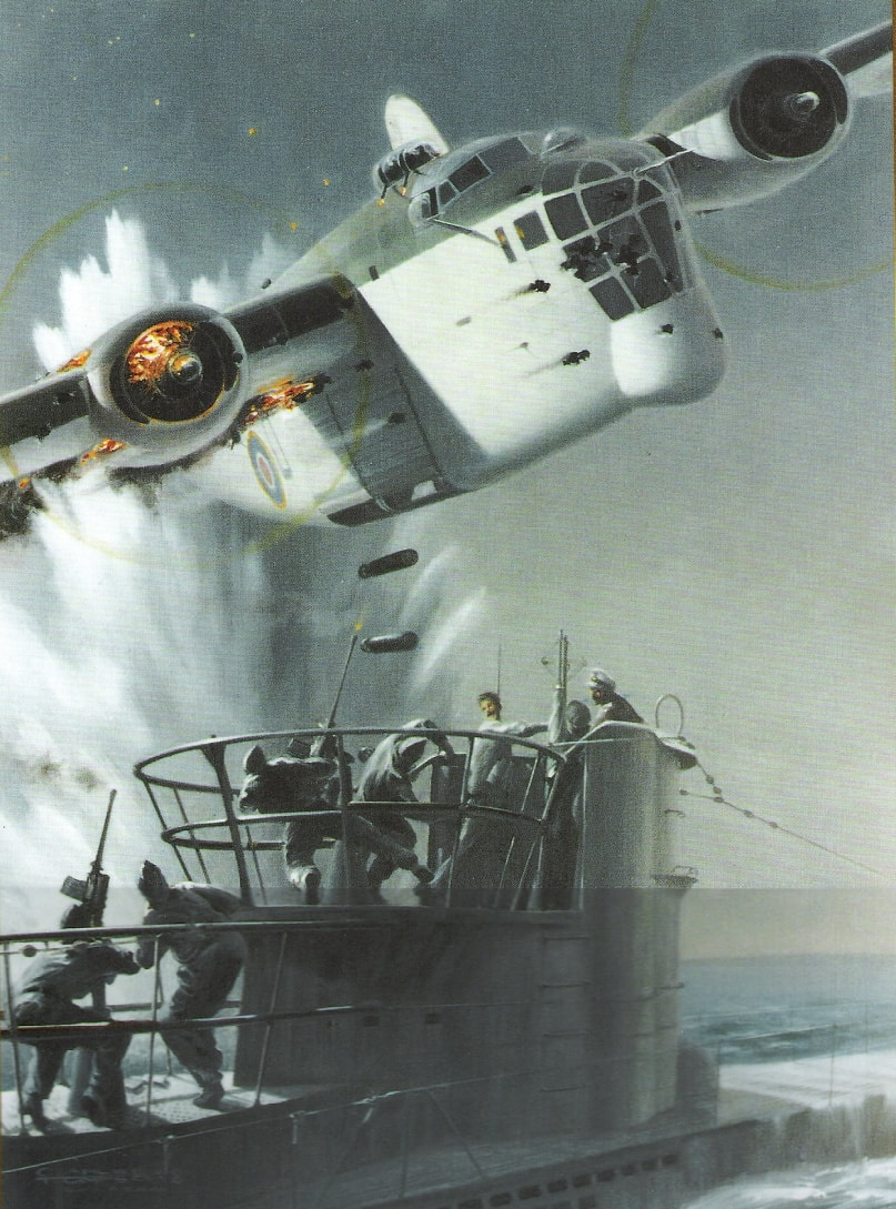
Later targets, of course, were deadly serious. German submarines attacking the Atlantic convoys bringing Britain food, fuel and war supplies from the USA were trying to starve Britain, and in 1942 Bletchley Park was unable to decode their Enigma messages, because the Germans had introduced a new, more complex, version of their Enigma coding machine. The U-boats were also already wise to the earlier types of Air to Surface Vessel radar, and listened for them on special receivers. Lovell and his colleagues built a microwave version of Air to Surface Vessel (ASV) radar. This Allied jump to microwave radar was not expected by the Germans, and for a while Allied aircraft, equipped with this radar, could swoop down unexpectedly on the U-boat, as in this picture – the microwave radar is on the chin of the Liberator aircraft. The effect was even more terrifying at night, when the aircraft would approach almost silently and then suddenly switch on a powerful searchlight, the ‘Leigh Light’.
One type of ASV radar, codenamed ‘Vixen’, was particularly cunning – when the Germans became able to microwave radar, the British adapted it to give a weaker signal as it approached its target, rather than the strengthening signal which was normal. As a result, the U-boat believed the aircraft was flying away, when it was in fact drawing closer…and then the searchlight was switched on, and the attack commenced. There were many different factors in the defeat of the U-boat in the North Atlantic – the breaking of the Enigma codes, small ‘escort’ aircraft carriers, the availability of more Allied destroyers, frigates and corvettes, high-frequency direction finding (called Huff Duff for short), better anti-submarine weapons and better training. But radar, whether mounted on a ship or on an aircraft, played a significant role on the hunting down of many submarines, and Langton’s Leeson House played the key role in its development. Early in 1942, Purbeck played a part in a daring mission to capture a radar system from the Germans. Radar signals had been detected from Bruneval on the French coast, and then a daring Photographic Reconnaissance pilot managed to obtain several photographs like this, which showed a strange bowl-fire like object in front of a house – a German radar! It was immediately recognised that we could get small boats very close in to a small beach nearby, and a commando raid could photo the equipment and if possible, bring it back to the UK. The plan was for a parachute drop of commandos, including RAF Flight Sergeant Cox, a radar specialist who would identify the key parts of the equipment, flash-photo as much of it as possible and dismantle it for the commandos to carry down a cliff-path to fast motor-boats waiting at the beach. However, on the night, one group of commandos was dropped in the wrong place, and the Germans put up a stiff resistance. Someone also forgot that taking flash photos in the middle of a night-time fire-fight is not a good idea, and Cox found himself doing rapid dismantling of the radar with bullets flying past his ears. Two commandos put a large boot on either side of the equipment rack and literally tore the equipment out of its mountings, then they staggered down the cliff with their haul. The Navy arrived just in time, and Cox and the commandos climbed aboard with their valuable haul. Crown Copyright
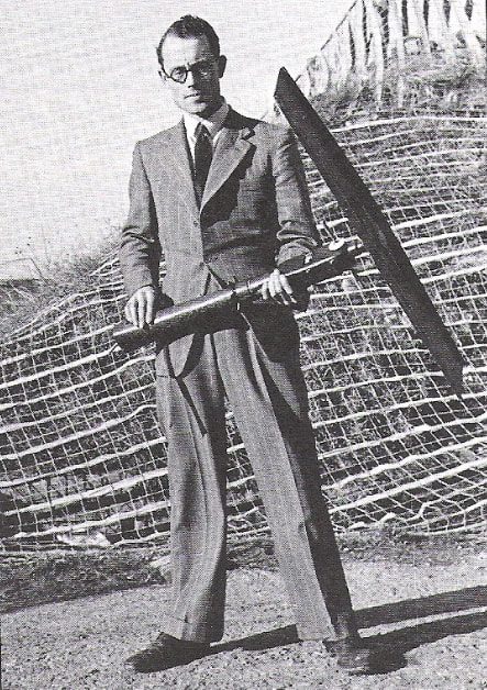
Cox reported at once to a TRE scientist who had come with the boats, Don Preist, shown here with a bit of the aerial of the German radar. His first request was that of any landsman embarked on a 40-knot motorboat speeding over a choppy sea – “Permission to be sick, sir?”. Preist, not knowing if they’d get back, refused permission until a rapid description of the radar was gained, after which Cox went back on deck.
Safely home, the Wurzburg yielded its secrets to the Worth scientists who saw that the construction of the German sets was far in advance of our own in its detail and its precision. However, what the Germans had not done – but the British had – was to weld radar into the British air defence system and practice with it for years before the war. It was, amazingly, in organisation rather than in raw technology that the British had triumphed in the Battle of Britain. Prime Minister Churchill said “The Germans had developed a technically efficient system in some respects ahead of our own. But we had woven all into our air defence system, and in this we led the world”, or as the German fighter General Galland said “The British had from the first an extraordinary advantage, never to be balanced out at any time in the whole war – their radar and fighter control network. It was for us a very bitter surprise that Britain had a close-meshed radar system to the highest level of technique – we had nothing like it”. But back in 1942, someone in high places had an “Omigod” moment - as in “Omigod, we landed a raiding party near a radar station close to the Channel, but our main radar research station in Purbeck is also on the shore of the Channel with an easy route to the sea - GET THEM OUT OF THERE!” Crown Copyright
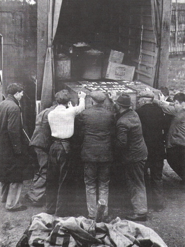
A place as far from marauding Germans as possible – Malvern College in Worcestershire – was located, and the entire research establishment and its 2,000 people moved there, lock, stock and barrel, at the end of May in 1942.
Langton is peaceful now, but Leeson House and Durnford House helped save this nation from starvation and had a key role in starting the struggle to liberate Europe - no mean feat for a quiet Dorset village. |
© 2024 Langton Matravers Local History and Preservation Society
